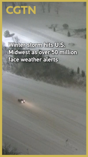
Snow and howling winds blanketed roads in Grand Rapids, Michigan, early on Nov 30 as a hefty winter storm swept across the U.S. Midwest ❄️🌬️. With 50M+ people nationwide under winter weather alerts, this storm is a chill reminder that extreme weather can pop up anywhere—even in places where snow is part of the norm.
The U.S. National Weather Service says these snowy, windy conditions will last through Dec 2. And just when you think the coast is clear, another system is queued up to deliver rain, thunderstorms, and a wintry mix from the Gulf Coast to the Northeast next week.
Though snow might feel exotic for many South and Southeast Asians, we all know extreme weather firsthand—like sudden monsoon floods, heatwaves, or unexpected storms 🌏💧🔥. Tuning into global weather alerts helps us prepare for local surprises, too. A reliable weather app on your phone is your new BFF when the skies go wild 📲.
Here’s what to note:
- ☃️ 50M+ people under winter alerts across the U.S. through Dec 2.
- 💨 Rough winds and heavy snow hit the Midwest, disrupting travel.
- ⛈️ A follow-up system will bring rain, thunderstorms, and wintry mix to the East Coast.
- 🔍 Extreme weather events are on the rise globally—time to stay climate-aware!
Keep your layers ready, stay plugged into weather updates, and remember: preparedness is key wherever you call home!
Reference(s):
Winter storm hits U.S. Midwest as over 50 million face weather alerts
cgtn.com


