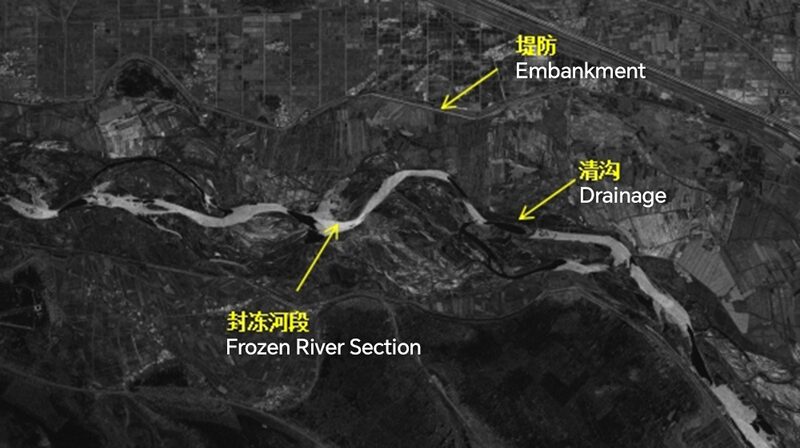
Hey tech enthusiasts! 📣 Guess what? China’s making waves—literally! 🌊 Their first-ever water conservancy satellite just sent back some incredible images, and they’re a game-changer for water management across Asia. 🌏
So, what’s the buzz all about? 🤔 Launched recently, this satellite is designed to monitor water bodies, floods, and drought conditions. With its high-res imaging, it can keep an eye on rivers, lakes, and reservoirs, helping authorities make smarter decisions about water use and conservation. 💧
Why should you care? Well, water issues affect us all, especially in South and Southeast Asia where monsoon seasons can be unpredictable. This tech could mean better flood warnings 🌀, improved irrigation systems 🌱, and smarter urban planning for our rapidly growing cities. 🏙️
Plus, it’s a step forward in using space technology for environmental good! 🚀🌟 Imagine the possibilities when countries collaborate and share data to tackle climate challenges together. 🤝
Stay tuned for more updates on how this satellite will impact our region. Until then, keep reaching for the stars—both literally and figuratively! ✨
Reference(s):
cgtn.com


