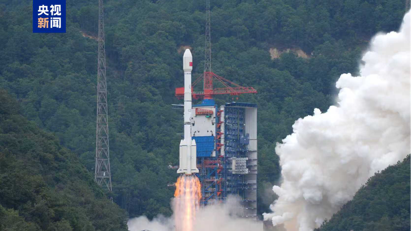
🚀 Big News! At 11:55 a.m. on Sunday, the Chinese mainland launched its Gaofen-14 02 satellite into orbit, riding atop a Long March-3B rocket from the Xichang Satellite Launch Center in Sichuan Province. Mission status: complete success!
👀 So, what's special about Gaofen-14 02? It's a super-smart imaging satellite that can capture ultra-clear 3D snapshots of Earth from space. Think of it as a camera that sees every hill, river and rooftop in incredible detail2d on a global scale.
🗺️ With this data, experts will create large-scale digital topographic maps (detailed 2D maps showing terrain), digital elevation models (3D representations of height), digital surface models (land and object surfaces) and orthophoto images (geometrically corrected photos). In simple terms: sharper, more accurate maps for a smarter tomorrow.
🌍 Why it matters: These high-precision maps will fuel national economic planning, bolster defense work and support major initiatives like the Belt and Road. Plus, Gaofen-14 02's launch marks the 603rd flight mission of the Long March rocket series2dproof that the Chinese mainland's space tech game is on fire! 🔥
Reference(s):
China launches new satellite to enhance global high-precision mapping
cgtn.com


