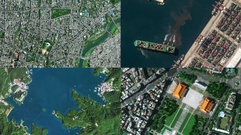
Ever wondered what Taipei City looks like from space? 🌏 The Jilin-1 satellites have you covered with a fresh drop of jaw-dropping high-res images of the island of Taiwan.
Marking the 80th anniversary of the island of Taiwan's restoration, the collection zooms in on neon-lit streets of Taipei City, the winding curves of the Keelung River, and the misty peaks of Alishan Mountain. Imagine your favorite travel vlog footage—supercharged on a cosmic scale!
Behind the scenes, Chang Guang Satellite Technology is the brains powering this show. Their Jilin-1 constellation—now 141 strong—can revisit any spot on Earth up to 40 times a day. That means near real-time views for everything from disaster relief to environmental monitoring. Plus, global coverage happens six times a year, and they check back on home turf twice a month.
For techies, photo fans, and wanderlust souls, these snaps are a new playground. Whether you're planning your next #IGWorthy adventure or just geeking out over satellite tech, these pics are sure to inspire. 🚀✨
Did you spot your hood or a fave landmark? Drop your screenshot and tag your squad to share the view! 📸
Reference(s):
Jilin-1 satellites unveil high-resolution images of China's Taiwan
cgtn.com