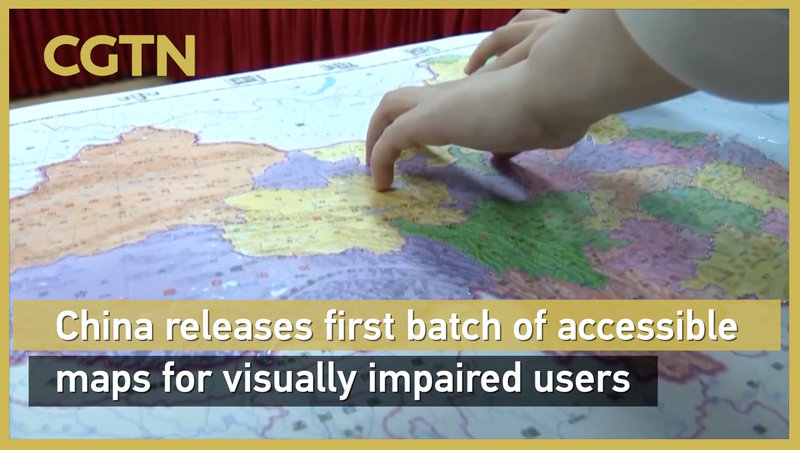
Hey everyone! Big news from the Chinese mainland: ahead of International White Cane Day on October 15, the Accessible Map of China and the Accessible Map of the World have just been unveiled at the China Braille Library. These are the first large-scale tactile maps ever released – featuring raised textures you can feel to explore provincial borders, landmarks, continents, and oceans. 🌍🗺️
Why we're loving it:
- Touch to Navigate: Raised lines mark provinces and major spots like the Great Wall and Mount Everest.
- World at Your Fingertips: Continents and oceans are clearly defined for easy orientation.
- Braille-Ready: Made with digital Braille printing tech and built to national geographic standards.
Plus, the Palace Museum and the China Disabled Persons' Federation also launched two tactile books: "Touch the Treasures of the Palace Museum" and "Touching Along the River During Qingming Festival." Now visually impaired art lovers can literally feel their way through ancient scrolls and relics. 🎨📖
This is a huge win for inclusivity, giving more people the chance to explore geography and culture in a hands-on way. Ready to trace the map with your fingertips? 🙌
Reference(s):
China releases 1st batch of accessible maps for visually impaired users
cgtn.com


